Around Castellfollit de la Roca
Castellfollit is one of the gateways to the volcanic area. Less than 20 km away by road you'll find volcanoes, a beech forest growing on lava, two medieval towns and the plain of the Vall d'en Bas.
The distances on this page are by road from the centre of Castellfollit. The one for Olot is the town council's; we calculated the rest with OSRM using OpenStreetMap data in October 2026, and they are approximate.
Sant Joan les Fonts (about 4 km)
The neighbouring village, upstream on the Fluvià, is the natural next step after your visit: here, too, you see the lava from below. Turisme Garrotxa highlights three stacked lava flows, from different eruptive vents, along the Molí Fondo stretch, with columnar and slab-like forms. You can explore them on a waymarked circular route of moderate difficulty.
Also in the village are the old Romanesque monastery, with a 12th-century baptismal font and a replica of the Majestat of Sant Joan les Fonts, and Juvinyà castle, a fortified house with a 12th-century tower and a permanent exhibition that Turisme Garrotxa recommends for families with children.
If you enjoy a proper walk, Garrotxa route 2 links Castellfollit, Begudà and Sant Joan les Fonts: 20 km, about 7 h 25 min, rated difficult and designed to be done in two stages.
Olot and its town volcanoes (about 7.5 km)
The Garrotxa's main town has volcanoes inside the town itself. One of them, Montsacopa, rises right in the middle of town, and Turisme Garrotxa calls it an urban volcano: a perfectly round crater, the church of Sant Francesc on top, two watchtowers from the 19th-century Carlist Wars and a 360-degree view over the town and other volcanoes. You climb it on an easy, waymarked path.
To make sense of everything you're seeing, Espai Cràter is an interactive exhibition built inside the Puig del Roser volcano, suitable for all ages according to Turisme Garrotxa. Check opening times and booking on its website before you go.
Olot is also the most convenient base if you're travelling without a car: see where to stay.
The Fageda d'en Jordà, Croscat and Santa Margarida (about 16 km)
South of Olot, on the Santa Pau road, lies the heart of the Natural Park:
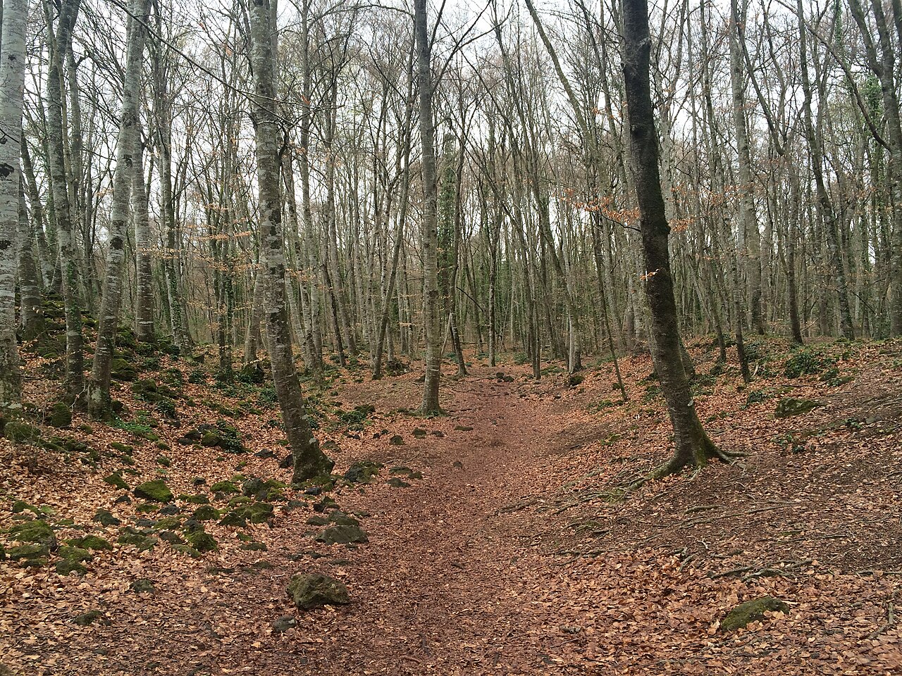
- The Fageda d'en Jordà, a beech forest growing on the lava flow from the Croscat volcano, between Olot, Santa Pau and Les Preses. According to Turisme Garrotxa, in autumn the ground is covered with ochre leaves, in spring the greens are at their most intense, and in summer the forest stays cool.
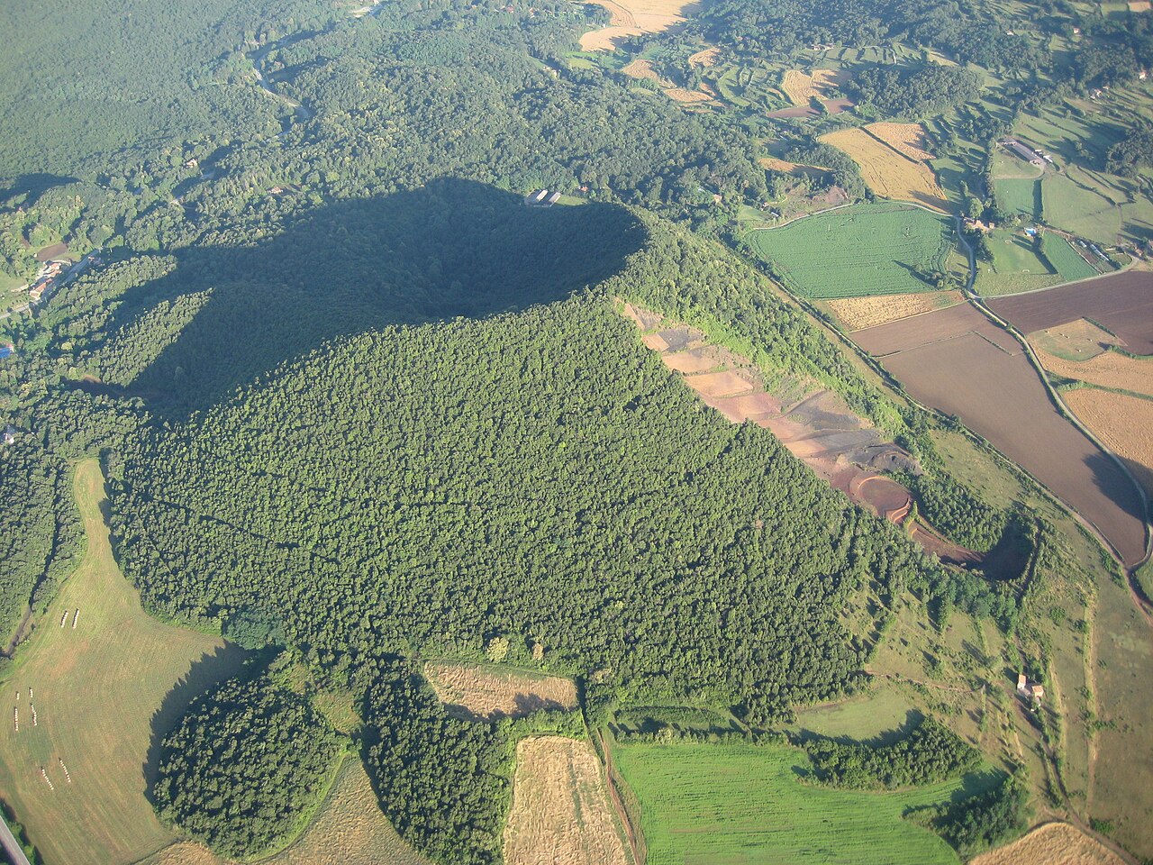
- The Croscat volcano, one of the most emblematic in the Iberian Peninsula. Old quarrying cut into its side, exposing layers of grey, black and reddish lapilli. Nearby is Can Passavent, a Natural Park information centre.
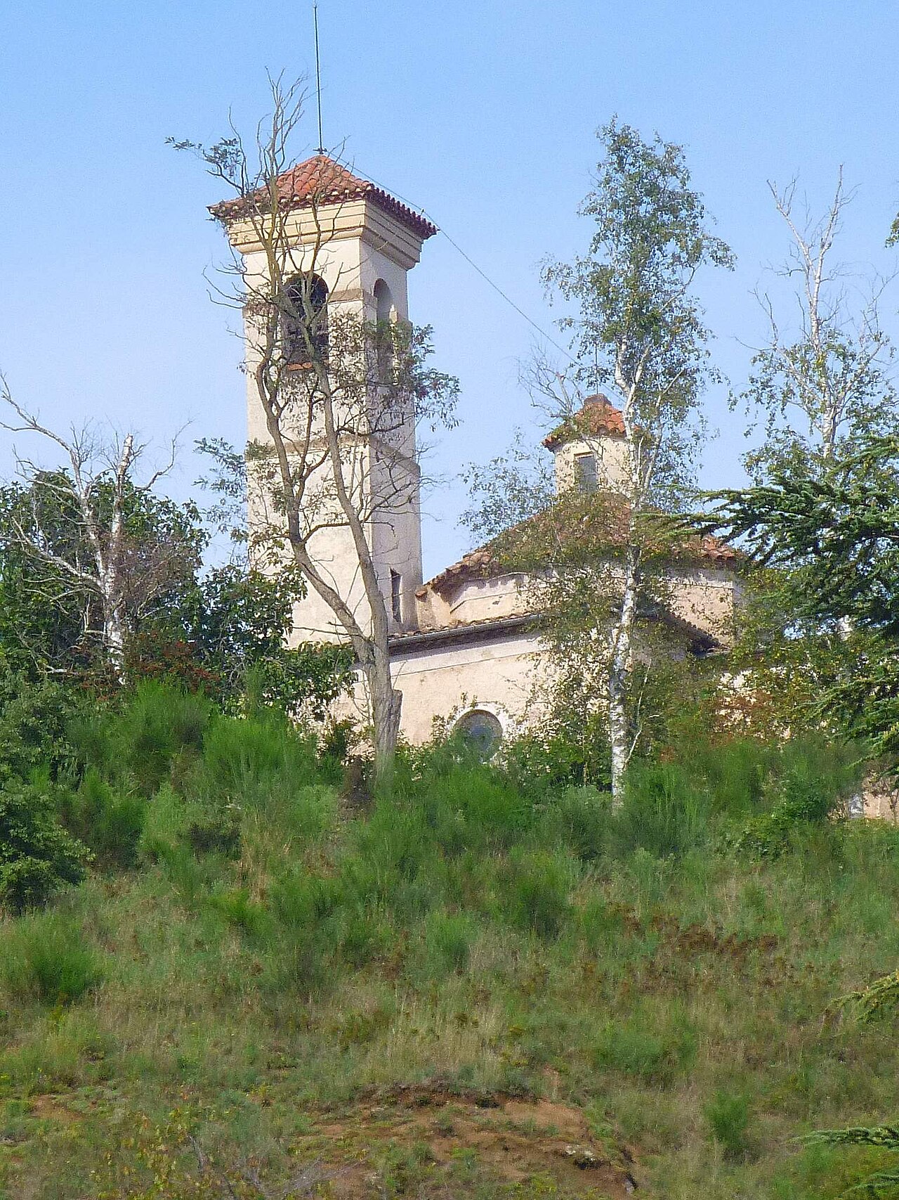
- The Santa Margarida volcano, with a Romanesque chapel in the middle of its crater, which measures about 2,000 metres round. You climb it on a family-friendly woodland path; there's a large car park at the foot, on the Olot–Santa Pau road.
Natural Park route 1 links all three: about 11 km, starting from the Santa Margarida car park. Turisme Garrotxa describes it as a half-day walk, giving 4 h 20 min on its route page, and advises doing it in spring, summer or winter, because in autumn the area gets very crowded.
Santa Pau (about 19 km)
A medieval village in the heart of the volcanic area, with an arcaded Plaça Major where markets and fairs were once held, the Gothic church of Santa Maria and the castle beside it. It's also home to the fesols de Santa Pau, beans with Protected Designation of Origin status. It pairs well with the Fageda and the volcanoes on the same day.
Besalú (about 14 km)
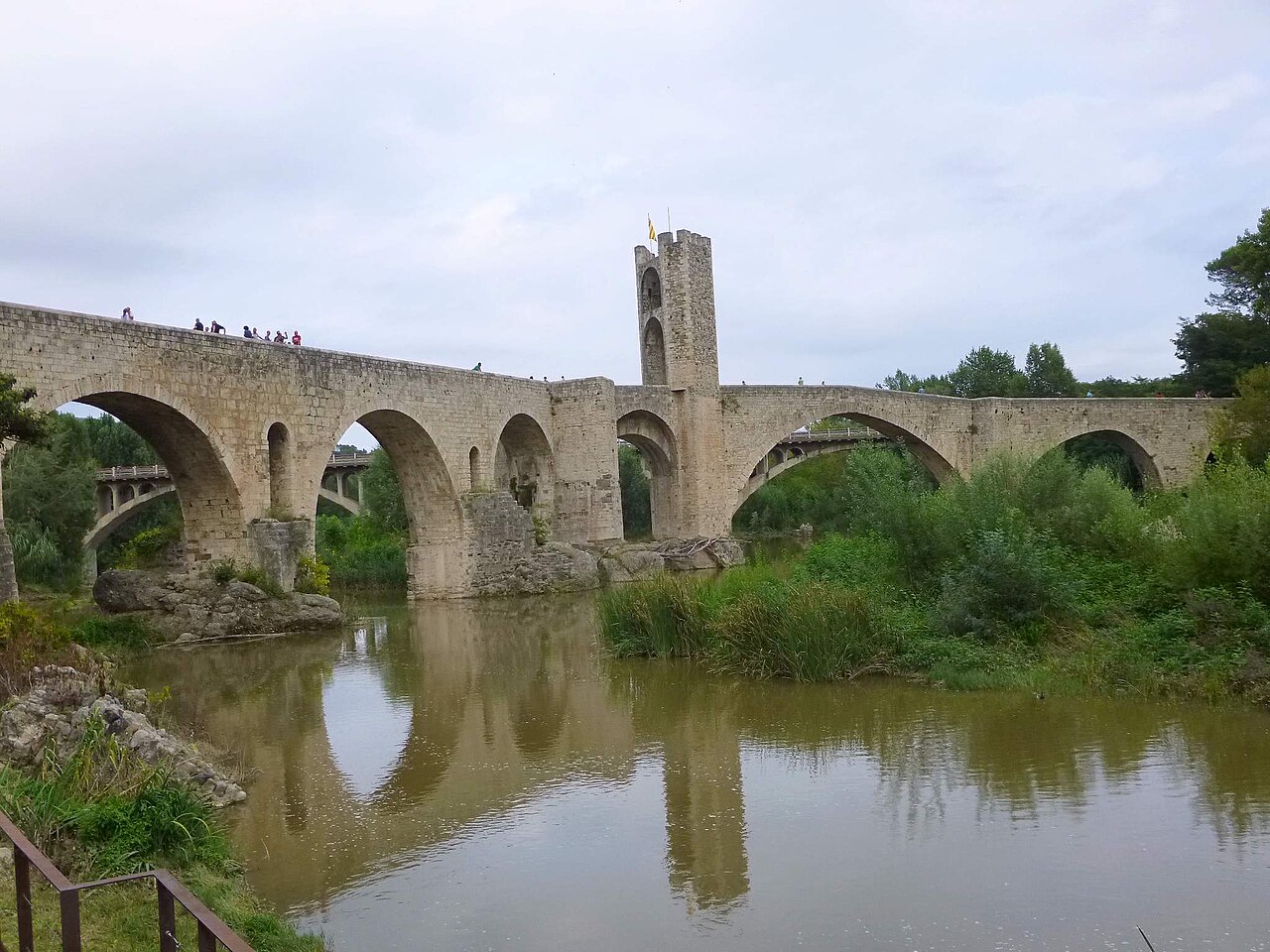
The Garrotxa's other great postcard view, downstream on the Fluvià. Its old bridge, Romanesque in origin, is 105 metres long, with seven arches and a fortified tower on a hexagonal plan. In the old Jewish quarter there's a mikveh, a ritual bath discovered by chance in 1964, which Turisme Garrotxa describes as one of the three found in the Iberian Peninsula. Besalú's tourist office runs guided tours all year round, and the Besalú Medieval fair is held on the first weekend of September.
The Vall d'en Bas (about 19 km to Els Hostalets d'en Bas)
South of Olot, a plain opens out beneath Puigsacalm and the Santa Magdalena massif. Turisme Garrotxa highlights Els Hostalets d'en Bas, a historic cluster of narrow lanes and stone houses; Sant Esteve d'en Bas, with its 12th-century Romanesque church; and Joanetes, known for its living nativity scene at Christmas. The Carrilet greenway runs through the valley and is ideal for cycling.
How to spend two or three days
A simple, unhurried way to divide up the area:
- Day 1: Castellfollit in the morning, with the walking route, and Sant Joan les Fonts in the afternoon.
- Day 2: the Fageda d'en Jordà, Croscat and Santa Margarida, with lunch in Santa Pau.
- Day 3: Besalú in the morning and, if you still have the energy, the Vall d'en Bas or Olot's Montsacopa.
When choosing where to stay for this plan, Olot sits in the middle of everything; Besalú and Sant Joan les Fonts are good alternatives if you'd rather be in a small village. All the options are in where to stay.
Places
Sant Joan les Fonts
The neighbouring village, about 4 km away, with three stacked lava flows beside the Fluvià and a former Romanesque monastery.

Olot
The capital of the Garrotxa, about 7.5 km away, with volcanoes inside the town itself, such as Montsacopa.
Montsacopa volcano
Olot's urban volcano, with a circular crater, the church of Sant Francesc and 360-degree views over the town.

Fageda d'en Jordà
Beech forest growing on the lava flow from the Croscat volcano, between Olot, Santa Pau and Les Preses.

Croscat volcano
One of the park's most iconic volcanoes, with a cut left by old quarrying that reveals its interior.
Santa Margarida volcano
Volcano with a Romanesque chapel in the middle of its crater, climbed on foot along a woodland path.
Santa Pau
Medieval village with an arcaded square, a Gothic church and a castle, right in the volcanic zone.

Besalú
Medieval town about 14 km away by road, with the fortified old bridge over the Fluvià and the mikveh of the former Jewish quarter.
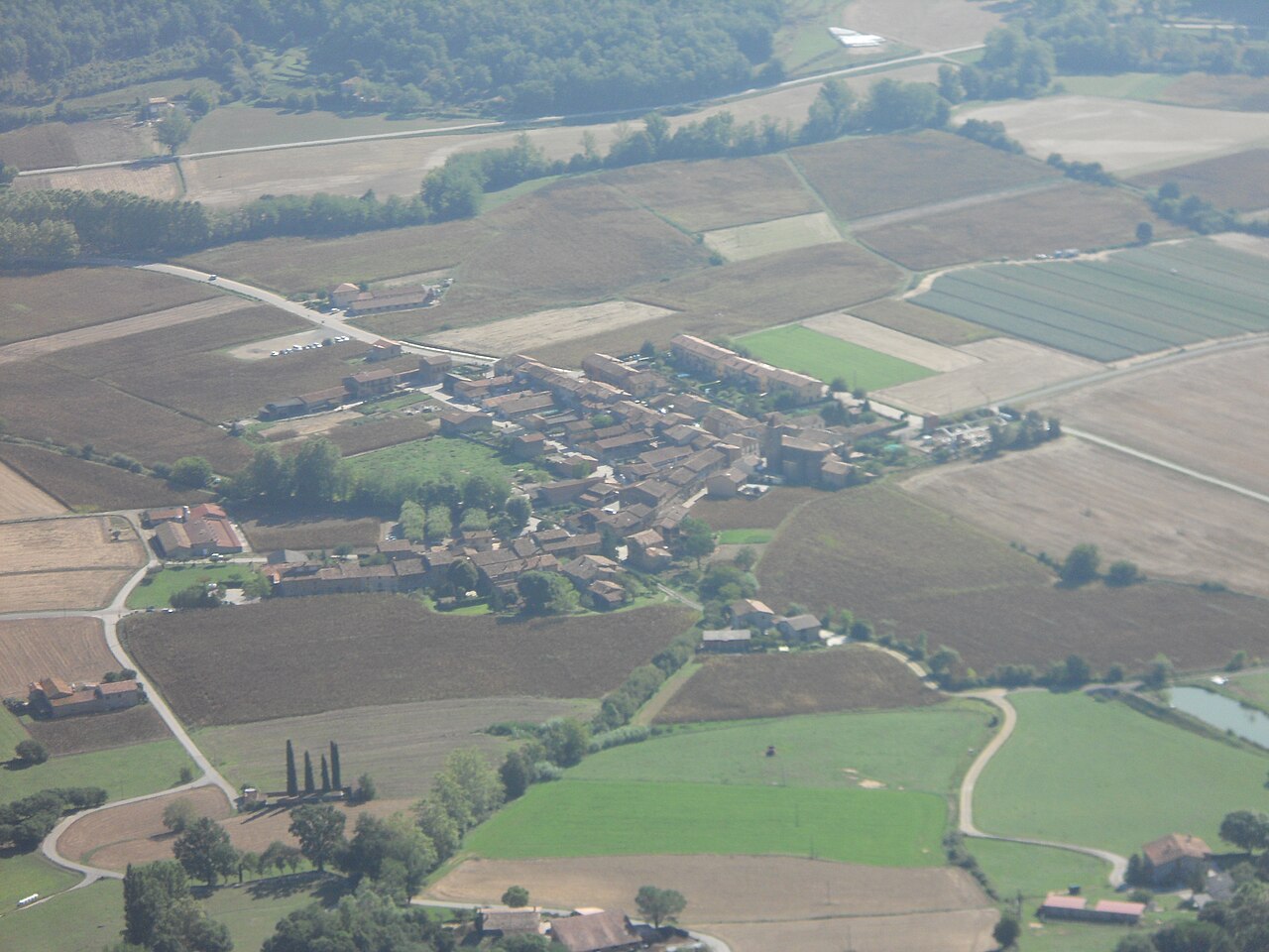

Els Hostalets d'en Bas (Vall d'en Bas)
One of the villages of the Vall d'en Bas, a historic ensemble of lanes and stone houses.
Places to stay
None of these links are affiliate links: we earn no commission from them.
Mas Violella
18th-century farmhouse of volcanic stone between Sant Joan les Fonts and Castellfollit, with several units that can be combined and an enclosed garden also designed with dogs in mind.
Hotel Borrell
Hotel in the centre of Olot, steps from the old town and the Olot-Girona greenway, with a garage for motorbikes and bicycles.
Mas Cantallops
Two rural holiday houses at the foot of the Croscat and Santa Margarida volcanoes, in the heart of the natural park.
Els Jardins de la Martana
Small hotel in an early 20th-century building on the far side of Besalú's old bridge, with views over the town.
Mas Garganta
Farmhouse stay with views over the Vall d'en Bas, on the La Pinya road, with rooms of different sizes, a vegetable garden and a pool.
Sources
- Coladas basálticas de Sant Joan les Fonts (Turisme Garrotxa) · accessed
- Antiguo monasterio de Sant Joan les Fonts (Turisme Garrotxa) · accessed
- Castillo de Juvinyà (Turisme Garrotxa) · accessed
- Reserva natural del volcán Montsacopa (Turisme Garrotxa) · accessed
- Espai Cràter (Turisme Garrotxa) · accessed
- Reserva natural de la Fageda d'en Jordà (Turisme Garrotxa) · accessed
- Reserva natural del volcán Croscat (Turisme Garrotxa) · accessed
- Volcán de Santa Margarida (Turisme Garrotxa) · accessed
- Fageda d'en Jordà, volcán de Santa Margarida y volcán Croscat, itinerario 1 (Turisme Garrotxa) · accessed
- Casco antiguo de Santa Pau (Turisme Garrotxa) · accessed
- Puente viejo de Besalú (Turisme Garrotxa) · accessed
- Micvé y sinagoga de Besalú (Turisme Garrotxa) · accessed
- Pueblos de la Vall d'en Bas (Turisme Garrotxa) · accessed
- Ruta del Carrilet, la vía verde (Turisme Garrotxa) · accessed
- Castellfollit de la Roca, ficha del municipio (Turisme Garrotxa) · accessed
- Castellfollit - Begudà - Sant Joan les Fonts, ruta 2 (Turisme Garrotxa) · accessed
- Com arribar-hi (Ayuntamiento de Castellfollit de la Roca) · accessed
- Ruta en coche a Sant Joan les Fonts (OSRM, datos de OpenStreetMap) · accessed
- Ruta en coche a Besalú (OSRM, datos de OpenStreetMap) · accessed
- Ruta en coche al volcán de Santa Margarida (OSRM, datos de OpenStreetMap) · accessed
- Ruta en coche a Santa Pau (OSRM, datos de OpenStreetMap) · accessed
- Ruta en coche a Els Hostalets d'en Bas (OSRM, datos de OpenStreetMap) · accessed