Plan your visit
How much time you need, when the old church is open, when the sun lights up the rock and what to expect from the slopes. With a table of sun times calculated for the village.
How long to spend
- A quick stop (about an hour). Park, walk through the old town to the Plaça de Josep Pla viewpoint and the old church, and look at the village from the road bridge.
- Two or three hours. Add the walk down to the river on the Natural Park's route 13, which also takes in the old town and the viewpoint. The official leaflet gives it 2.8 km and 1 h 15 min, with 125 metres of ascent and the same again of descent. Allow extra time for photos and, if you want to climb the bell tower, fit your visit around its opening hours.
- A full day. Castellfollit in the morning and Sant Joan les Fonts, with its lava flows, in the afternoon. Ideas on our nearby sights page.
- Two or three days. What the Garrotxa deserves if you also want to see the volcanoes, the Fageda d'en Jordà and Besalú. For that it's best to stay in the area: we help you choose where in where to stay.
Which season to choose
You can visit the village all year round, and the Natural Park leaflet describes the circular walk as suitable in any season. What changes with the date is this:
- The old church's opening hours. According to the town council (checked in October 2026), from 22 June to 11 September it opens every day except Tuesdays; in spring and autumn, only on Saturdays, Sundays and public holidays. Outside those periods the page gives no opening times. Details on the church page.
- The surroundings through the seasons. According to Turisme Garrotxa, the Fageda d'en Jordà beech forest is famous for its ochre autumn leaves, shows its most intense greens in spring and stays cool in summer. Its route 1 page advises going in spring, summer or winter, because in autumn the area gets very crowded.
- Festivals. The 2026 Festa Major, the village's annual festival, was held from 18 to 20 September, according to the town council's website. The Fira dels Picapedrers, the stonemasons' fair, with a market of local produce and crafts, takes place in spring: the council's events listing put it on 5 April in 2026, and the 2017 to 2019 editions were also in April. Check each year's date on the town council's website.
For the weather, look at the forecast from Meteocat, the Catalan weather service, or AEMET, Spain's national weather agency, for the village. The Park leaflet recommends checking the weather before setting out on a walk.
What time to go: the light on the cliff
The classic photo of Castellfollit is taken from below, looking up at the basalt wall, so the direction that wall faces matters. The long face of the cliff, the one above the Fluvià that you see from the road, faces north: both the OpenStreetMap geometry and the Universitat Politècnica de Catalunya (UPC) team that monitors it confirm this. The tip where the old church stands faces east and south-east.
From that and the sun's position through the year, you can work out the essentials. This is our own calculation, not an observation on the ground:
- In the morning, the sun rises in the east, and this is when it best lights the tip of the cliff and the church, seen from the Fluvià footbridge. Between the March and September equinoxes, the sun rises in the north-east and also lights the north face for the first few hours. The UPC team warns that there is often fog first thing.
- Around midday and early afternoon, the sun is to the south and south-west, behind the village if you're looking from the river or the road: the wall is in shadow and photos come out backlit and very contrasty.
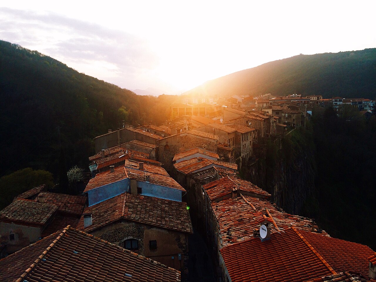
- Late in the afternoon, the low, warm light catches the rooftops and the bell tower from the west. Between spring and the end of summer, the sun is already in the north-west during the last few hours and can rake across the north face; the closer to June, the longer that light lasts.
- Between the September and March equinoxes, the sun rises in the south-east and sets in the south-west. The north face gets almost no direct sun; at most, the stretches that face slightly north-east may catch very low, raking light first thing.
The table below, calculated for the village's coordinates, gives the sunrise and sunset times and the start of the evening golden hour, when the sun drops below 6 degrees above the horizon, for the 1st and 15th of each month. Use it to plan: for a sunlit north face, come early between March and September, or stay for the last light in the summer months. To see the village in warm light, use the golden hour from the road bridge to the north, with the sun to one side; outside the summer months, the cliff face will be in shadow. The Plaça de Josep Pla viewpoint and the bell tower are on the eastern tip of the cliff, so, by the same calculation, at that hour the village lies to the west, against the light; what you see with the sun behind you are the slopes and hills in front of the viewpoint. And bear in mind that the bell tower closes before sunset. More tips in photography.
Slopes, children and reduced mobility
- Up top, little climbing. Going by the altitudes in the Park leaflet, there's only a small drop from Plaça de Catalunya (309 m) to Plaça de Josep Pla (286 m). The old town has narrow, cobbled streets.
- Down below, steps and a steep path. The demanding part is going down to the river: the Fluvià footbridge is at about 239 metres and the Toronell bridge at about 242, and the Via Annia path climbs from there to the old church, at 286 metres, in a very short distance. The leaflet rates the walk as easy, but it has steps: you can't do the whole loop in a wheelchair, and with a pushchair or stroller it's hard going.
- Braille signs. Turisme Garrotxa says the circular route through the old town to the viewpoints and the old church has signs in Braille.
- With children. The circular walk is short and varied, and Turisme Garrotxa marks it as suitable for children. In the Park, dogs must be kept on a lead and drones are not allowed.
In an emergency, call 112, as the Park leaflet itself reminds you.
Staying nearby
If you're staying on for the golden hour or want an early start the next day, sleeping in the village or very close by makes all the difference. The options, grouped by area and type of trip, are in where to stay.
| Date | Sunrise | Sunset | Golden hour begins (sun at 6°) |
|---|---|---|---|
Places to stay
None of these links are affiliate links: we earn no commission from them.
Fonda Ca la Paula
Family-run inn with a restaurant on Plaça de Sant Roc, in the village itself, with single, double and triple rooms and free parking for guests.
Can Castell
Three holiday apartments on Plaça del Cingle, in the heart of the old town, in the building that stands on the site of the old castle, on the edge of the cliff.
Hotel Borrell
Hotel in the centre of Olot, steps from the old town and the Olot-Girona greenway, with a garage for motorbikes and bicycles.
Els Jardins de la Martana
Small hotel in an early 20th-century building on the far side of Besalú's old bridge, with views over the town.
Sources
- Riscales de Castellfollit de la Roca, folleto del itinerario 13 (Parc Natural) · accessed
- Església Museu, horarios 2026 (Ayuntamiento de Castellfollit de la Roca) · accessed
- Web oficial del Ayuntamiento de Castellfollit de la Roca (Festa Major 2026) · accessed
- Fira dels Picapedrers (Ayuntamiento de Castellfollit de la Roca) · accessed
- Fira dels Picapedrers 2026 (agenda del Ayuntamiento) · accessed
- Reserva natural de la Fageda d'en Jordà (Turisme Garrotxa) · accessed
- Fageda d'en Jordà, volcán de Santa Margarida y volcán Croscat, itinerario 1 (Turisme Garrotxa) · accessed
- Risco basáltico de Castellfollit de la Roca, itinerario 13 (Turisme Garrotxa) · accessed
- Monitoring: photogrammetric system, Castellfollit de la Roca (Georisk, UPC) · accessed
- Castellfollit de la Roca, ficha del municipio (Turisme Garrotxa) · accessed
- Predicción municipal de Castellfollit de la Roca (Meteocat) · accessed
- Predicción para Castellfollit de la Roca (AEMET) · accessed
- Solar Calculator (NOAA Global Monitoring Laboratory) · accessed
- Cinglera de Castellfollit de la Roca, cara norte (OpenStreetMap) · accessed
- Cinglera de Castellfollit de la Roca, extremo este (OpenStreetMap) · accessed