Photography: where and when
The famous photo isn't taken from the village but from outside it: from the road or from the river. These are the spots, and this is the light you'll find at each one.
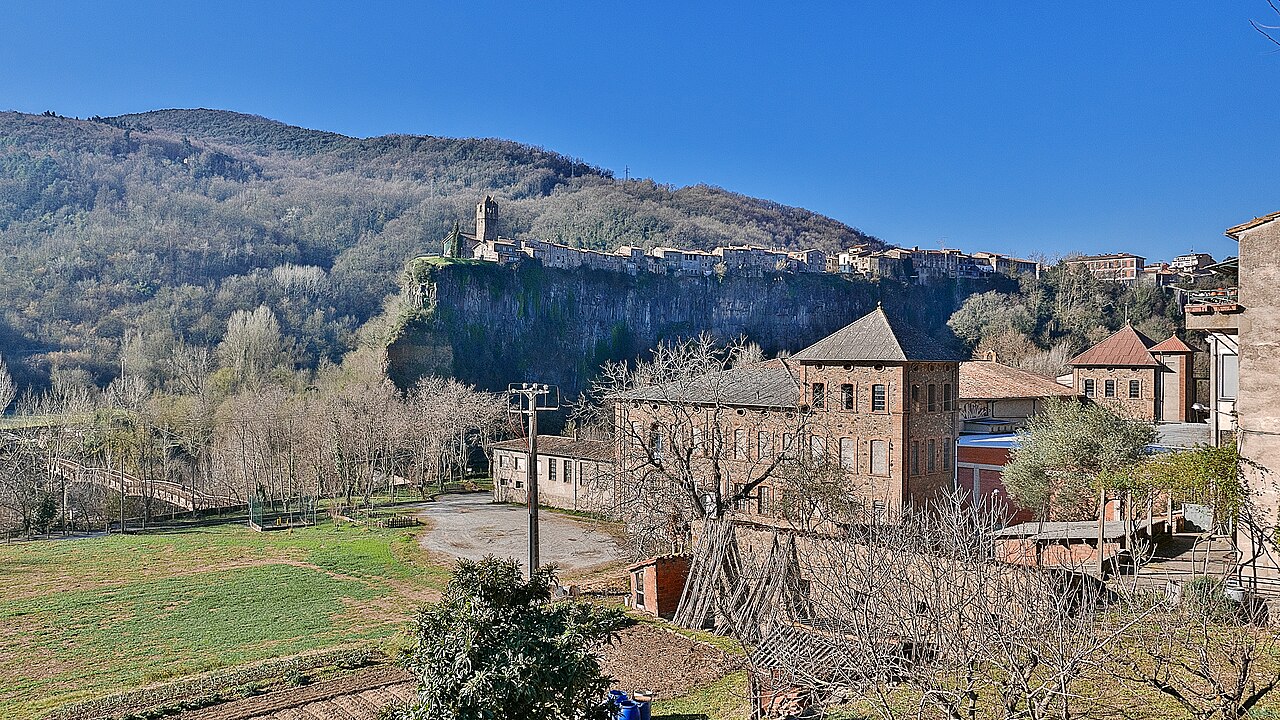
1. From the road bridge, to the north
This is the postcard view: the north face of the cliff straight ahead, with the houses lined up along the top. Femturisme also highlights the view of the cliffs and the village from the road as you arrive. OpenStreetMap marks a viewpoint next to the road bridge over the Fluvià, on the stretch now shown as the N-260z, and several of the panoramic photos of the village on Wikimedia Commons were taken from that spot or from the road.
Practical tip: don't stop on the bridge or on the road itself. Park the car and walk over carefully, because this road carries traffic. Parking options are in getting there.
The light: this face looks north. What follows is our own calculation, based on the shape of the wall in OpenStreetMap and the position of the sun, not an observation on the ground. Between the March and September equinoxes it gets sun first thing in the morning; around midday and early afternoon it's in shadow, with the sun behind the village. In those same months, late in the afternoon the sun is already in the north-west and can rake across it, and the closer to June, the longer that light lasts. The Universitat Politècnica de Catalunya team that photographs this wall every hour explains that, because it faces north, the sun shines straight into their cameras, and that there is often fog first thing: allow for both.
2. From the Fluvià footbridge
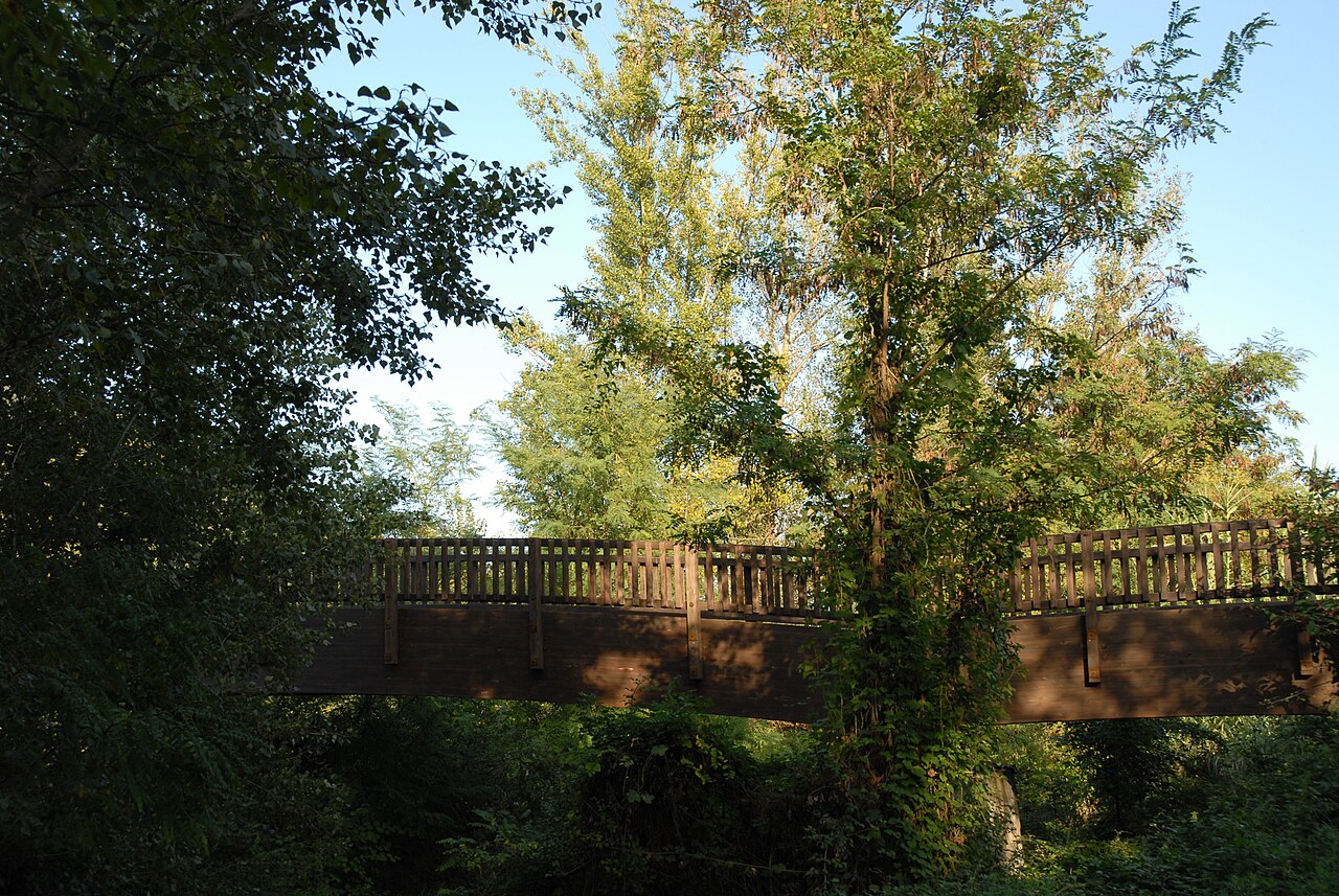
The wooden footbridge crosses the river to the east of the village. The Natural Park leaflet points out that from here you see the village and the eastern end of the cliff, right below the viewpoint. This is the photo with the water in the foreground and the basalt columns clearly visible.
The light: by the same calculation, the tip of the cliff faces east and south-east, so the best time is the morning, when the sun lights it head-on. In the afternoon it's backlit.
From the riverbank, following the path through the vegetable gardens, there are more angles on the cliff with the village on top. The whole route is part of the walking route.
3. From above: the viewpoint and the bell tower
- The Plaça de Josep Pla viewpoint. From here you can't see the cliff, but you can see the Fluvià and Toronell valleys, the hill of Cós and, below, the footbridge. The square is on the eastern tip of the cliff. By our calculation, early in the morning, looking east, you'll be facing the sun; late in the afternoon it will be behind you, lighting the slopes and hills you can see from here head-on. The village and the old church lie to the west: if you turn towards them at that hour, you'll see them against the light.
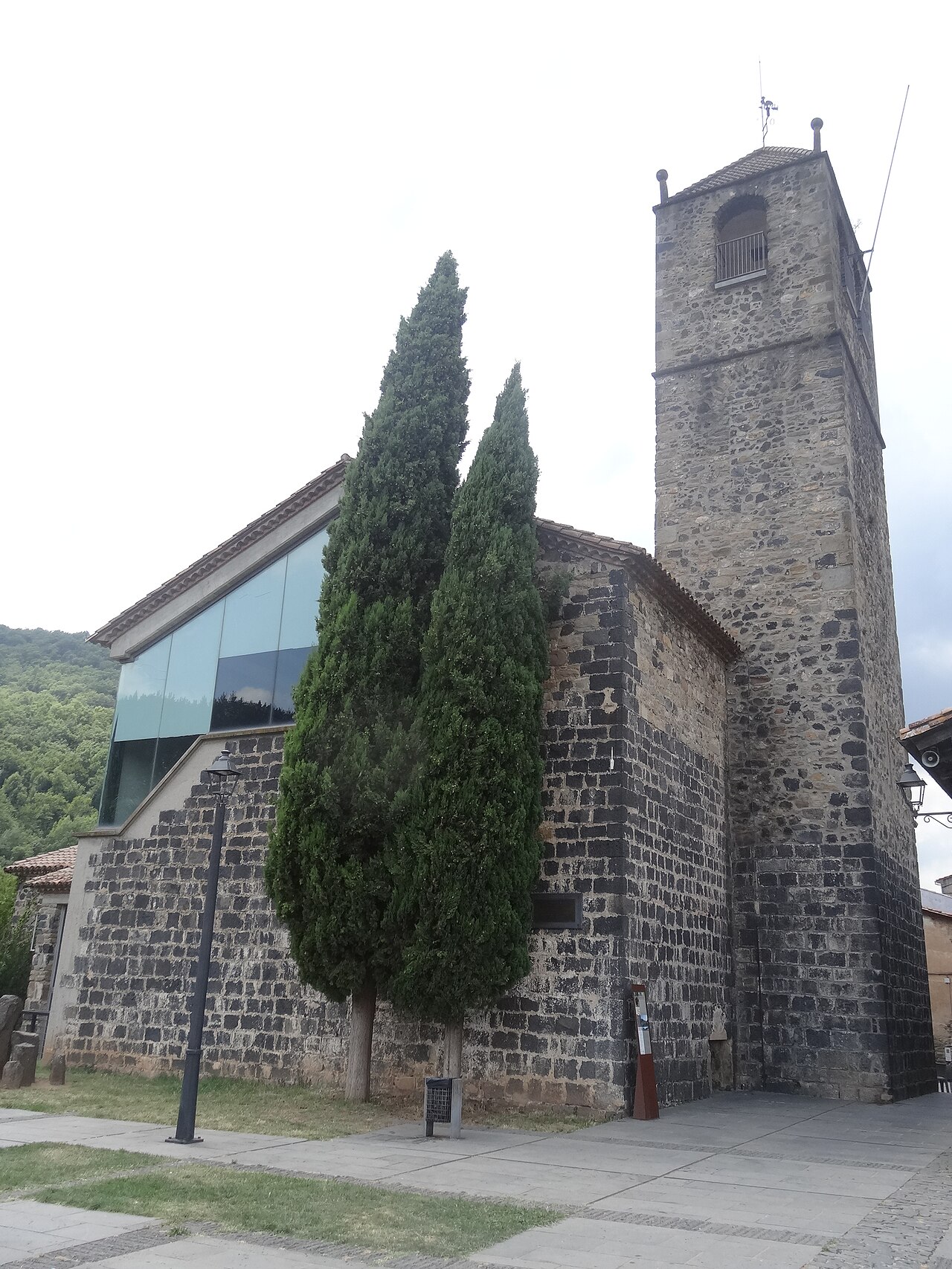
- The bell tower of the old church. The view down over the village rooftops. The bell tower is also on the eastern tip, so, by the same calculation, you'll see the rooftops, which lie to the west, with the sun behind you in the morning and against the light late in the afternoon. Also, according to the town council, in summer it closes at 7:30 pm, before sunset, and in spring and autumn it only opens at weekends and on public holidays. Compare its hours with the sun-times table in plan your visit.
When to go, in short
Based on our calculation of the sun's position:
- For the cliff in sunlight: early in the morning, especially between March and September, if the fog allows; in summer, also the low, raking last light of the evening.
- For the village in warm light: the evening golden hour from the road, to the north, bearing in mind that outside the summer months the wall will be in shadow. From above, on the eastern tip, the village is backlit at that hour.
- For the views from the viewpoint: late afternoon, with the sun behind you.
- To avoid harsh contrast: overcast days or the first hours of the morning.
Sunrise, sunset and golden-hour times for the 1st and 15th of each month are in the table in plan your visit.
Rules worth knowing
The cliff and the riverside paths are inside the Garrotxa Volcanic Zone Natural Park. According to the route leaflet:
- Drones are not allowed, nor any other flying devices, in the Natural Park.
- Professional photo shoots and filming need special permission from the Park.
- Most of the land is privately owned: respect the vegetable gardens and the peace and quiet of the people who live there.
Places

View from the Fluvià bridge
Beside the road bridge over the Fluvià, north of the village, you see the north face of the cliff head-on, with the houses along the top.
.jpg)
Footbridge over the Fluvià
Wooden footbridge over the river, with one of the most complete views of the village and the eastern end of the cliff.
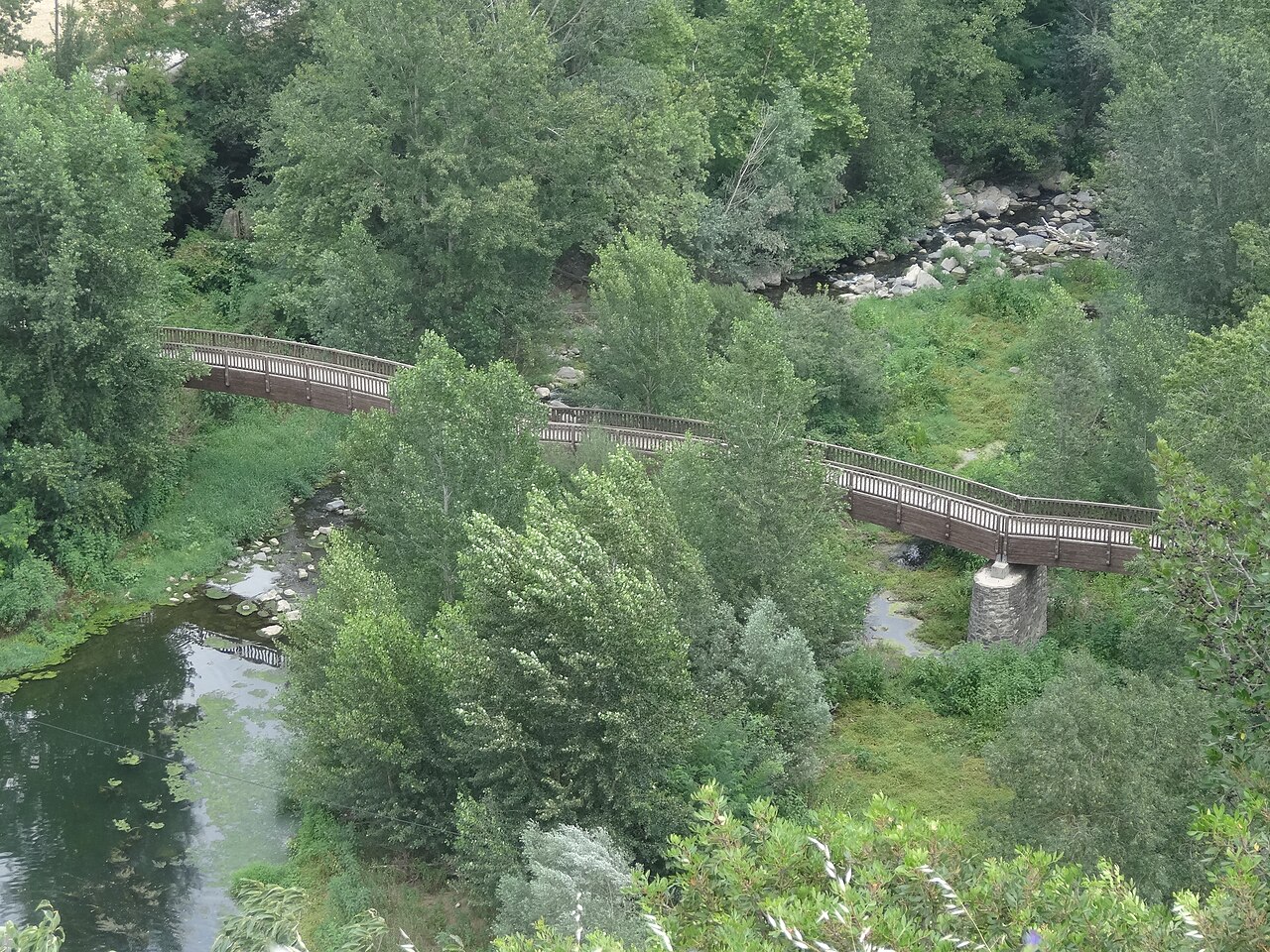

Plaça de Josep Pla viewpoint
The square on the edge of the cliff, next to the old church, with views over the Fluvià and Toronell valleys.
.jpg)
Old church of Sant Salvador
The village's old church, at the far end of the cliff, now a cultural space with a bell tower open to visitors.
Sources
- Castellfollit de la Roca (Femturisme) · accessed
- Riscales de Castellfollit de la Roca, folleto del itinerario 13 (Parc Natural) · accessed
- Castellfollit de la Roca, ficha del municipio (Turisme Garrotxa) · accessed
- Mirador junto al Pont del Fluvià (OpenStreetMap) · accessed
- Pont del Fluvià, carretera N-260z (OpenStreetMap) · accessed
- Panorámica de Castellfullit de la Roca, con la ubicación de la cámara (Wikimedia Commons) · accessed
- Castellfollit de la Roca i la cinglera basàltica des de la carretera GI-522 (Wikimedia Commons) · accessed
- Vistes des del mirador de Castellfollit de la Roca (Wikimedia Commons) · accessed
- Monitoring: photogrammetric system, Castellfollit de la Roca (Georisk, UPC) · accessed
- Cinglera de Castellfollit de la Roca, cara norte (OpenStreetMap) · accessed
- Cinglera de Castellfollit de la Roca, extremo este (OpenStreetMap) · accessed
- Solar Calculator (NOAA Global Monitoring Laboratory) · accessed
- Església Museu, horarios 2026 (Ayuntamiento de Castellfollit de la Roca) · accessed
