The medieval bridge over the Toronell and the Via Annia
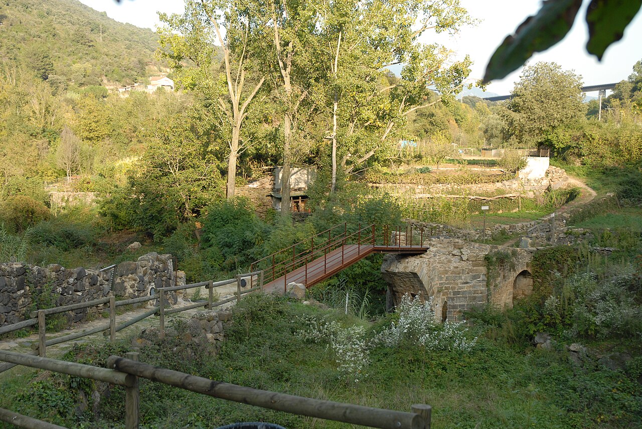
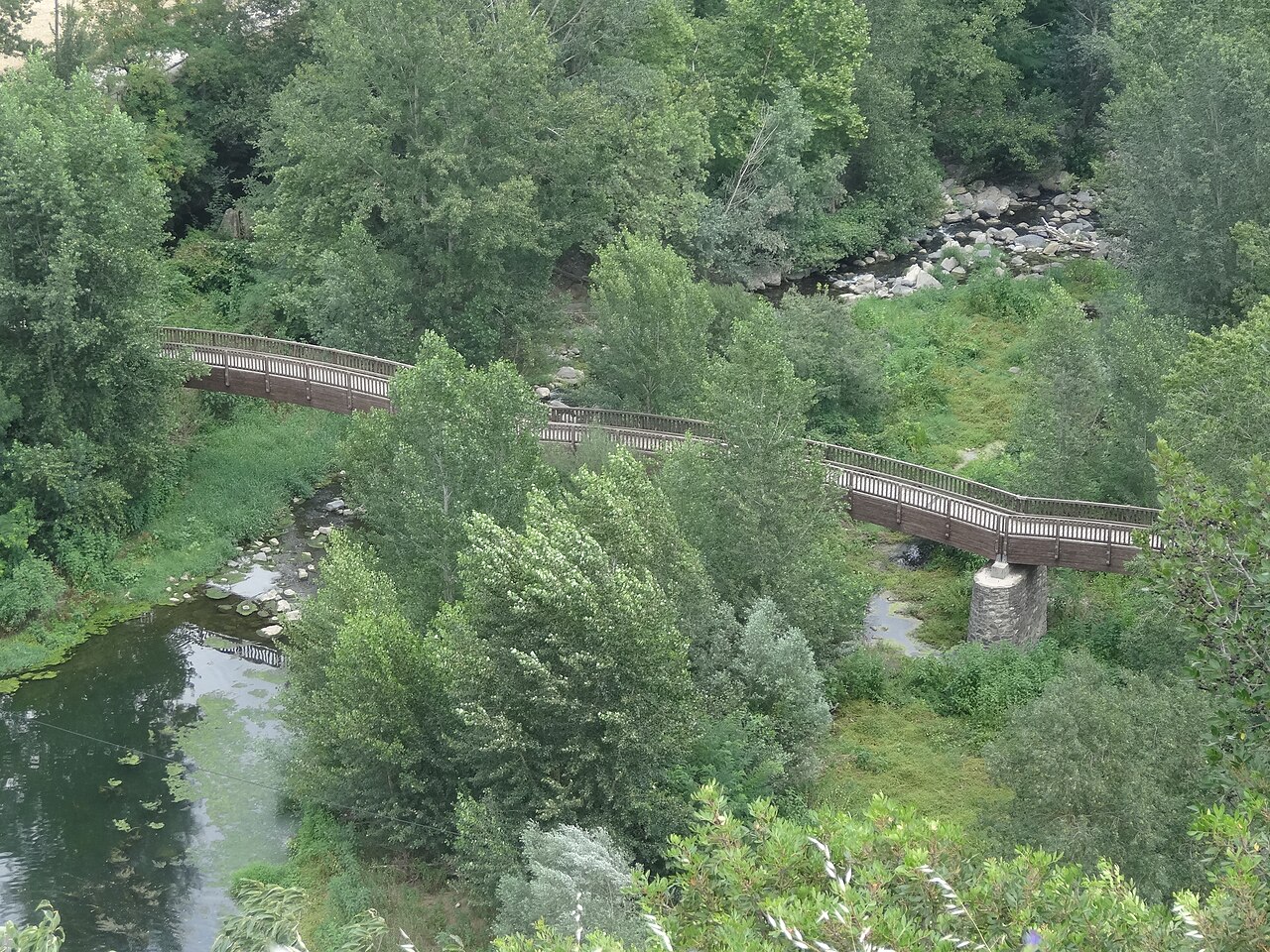
Below the village, by the vegetable gardens, a bridge with Gothic remains and a cobbled path of Roman origin link the river with the tip of the cliff.
- Coordinates
- 42.2179, 2.55506 · View on OpenStreetMap · Source
The bridge over the Toronell
The Toronell is the small river that runs along the south side of the cliff before joining the Fluvià. It's crossed by a bridge that the Natural Park leaflet calls the medieval bridge: there are records of a bridge at Castellfollit from 1074, and what you see today keeps medieval and Gothic elements from between the 14th and 16th centuries.
Its history is that of a crossing battered by floods. The town council's heritage inventory records that the flood of 3 April 1970 swept away much of what remained of the Gothic bridge, and the Park leaflet says it was rebuilt afterwards.
Don't expect a grand stone bridge. Patrimoni Garrotxa describes the present crossing as a metal bridge and notes that the Gothic remains survive at its base: that's where to look for the old part.
The Via Annia
From the bridge, a cobbled path climbs towards the old church of Sant Salvador. The Park leaflet identifies it as a stretch of the Via Annia, the Roman road that crossed the Garrotxa on its way to the Ripollès; here it links the village above with the vegetable gardens by the Toronell and then carries on towards the other river. Turisme Garrotxa also notes that part of the walk through the village follows this road.
It's one of the most characterful stretches of the circular walk: the cobbles run down beside the basalt wall and come out at the top on the open space of the viewpoint. It's also a stiff climb: going by the altitudes in the leaflet, you go from about 242 metres at the bridge to about 286 at the church in a very short distance. Bear this in mind if you have a pushchair or limited mobility.
The broken bridge over the Fluvià
North of the village, next to the current road bridge over the Fluvià, are the remains of another bridge. The town council explains that this earlier bridge was built in 1908, blown up during the Republican retreat at the end of the Civil War, and that the 1940 flood destroyed two of its arches. It was never rebuilt: Patrimoni Garrotxa calls it the Pont Trencat, the broken bridge, and points out that it marks the old strategic crossing between the Empordà and Olot.
Fitting it into your visit
The bridge and the Via Annia are on the Park's route 13, between the vegetable gardens and the old church. If you do the full walking route you'll pass both, as well as the Fluvià footbridge.
Places
.jpg)
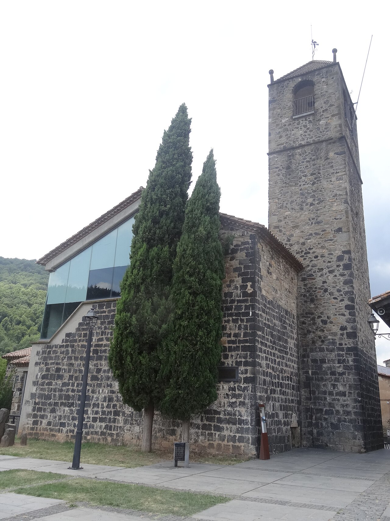
Old church of Sant Salvador
The village's old church, at the far end of the cliff, now a cultural space with a bell tower open to visitors.
.jpg)
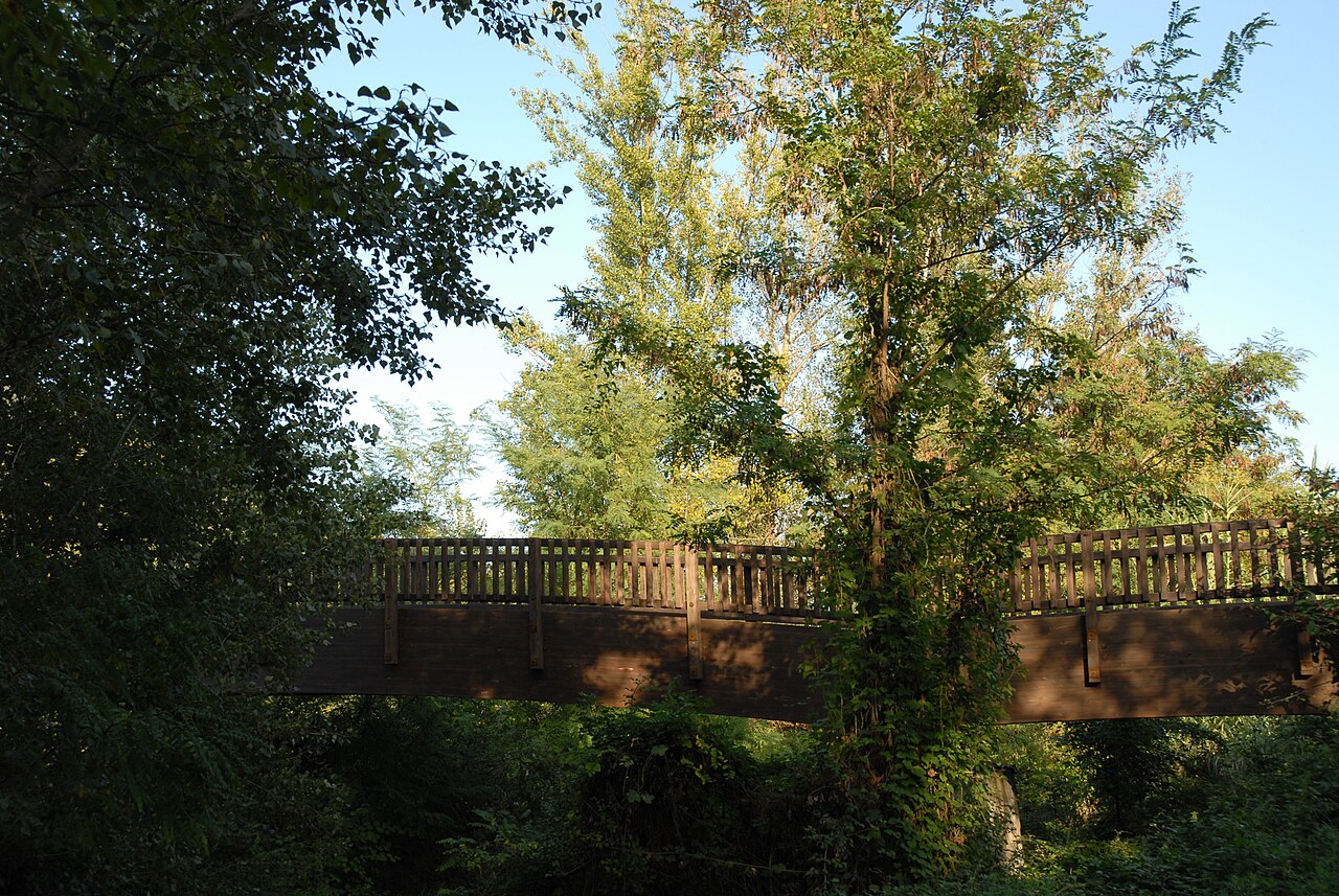
Footbridge over the Fluvià
Wooden footbridge over the river, with one of the most complete views of the village and the eastern end of the cliff.
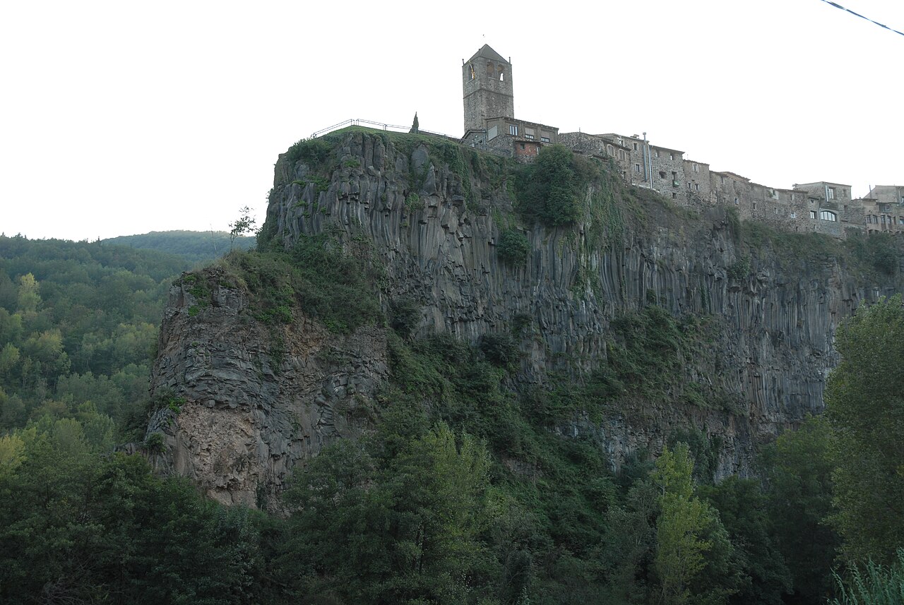

Basalt cliff of Castellfollit
The basalt wall, about 40 to 50 metres high depending on the source and almost a kilometre long, on which the village stands.
Nearby
Old church of Sant Salvador
The village's old church, at the far end of the cliff, now a cultural space with a bell tower open to visitors.

Plaça de Josep Pla viewpoint
The square on the edge of the cliff, next to the old church, with views over the Fluvià and Toronell valleys.
Basalt cliff of Castellfollit
The basalt wall, about 40 to 50 metres high depending on the source and almost a kilometre long, on which the village stands.
Sources
- Riscales de Castellfollit de la Roca, folleto del itinerario 13 (Parc Natural) · accessed
- Patrimoni arquitectònic (Ayuntamiento de Castellfollit de la Roca) · accessed
- Las coladas de lava (Patrimoni Garrotxa) · accessed
- Castellfollit de la Roca, ficha del municipio (Turisme Garrotxa) · accessed
- Pont Medieval (OpenStreetMap) · accessed